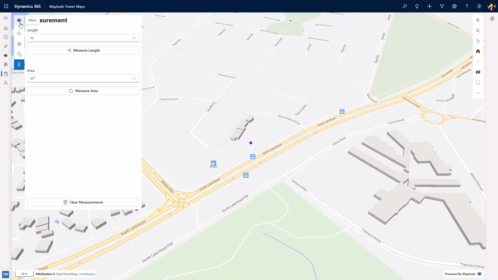
Measurements
The Measurements tool lets you interactively calculate distances (lines) and areas (polygons) directly on the map without leaving the interface. It’s ideal for quick feasibility checks, planning, or validating spatial assumptions.
Modes
| Mode | Geometry Drawn | Output | Typical Uses |
|---|---|---|---|
| Length | Polyline (multi‑segment) | Total distance | Routing estimates, corridor widths, linear assets |
| Area | Polygon | Surface area | Site footprint, coverage zones, allocation planning |
Both modes support multiple active measurements.
Desktop Workflow
Measure Length
-
Open the Measurements tool.
-
Choose units (optional) from the Units dropdown.
-
Click Measure Length.
-
Click to place the first point; continue clicking to add segments.
-
Double‑click to finish (or press Enter while hovering the final vertex).
-
The total length label appears at the final vertex.
Measure Area
-
Open the Measurements tool.
-
Select units for area (e.g., m², km², ha) if needed.
-
Click Measure Area.
-
Click to add vertices; shape updates as you go.
-
Double‑click the last vertex to close the polygon.
-
The area label appears at the centroid.
Create several independent measurements; they remain until you click Clear Measurements or leave the map session.
Mobile Workflow
-
Open the Measurements panel from the main menu.
-
Tap the mode (Length or Area).
-
Pan with one finger to position the crosshair; tap Add Point (or similar label) to place each vertex.
-
For Length: add segments until satisfied, then tap Finish (or double‑tap last point if supported).
-
For Area: add vertices; tap Finish to close and calculate.
-
Tap Clear to remove all, or start a new measurement directly.
| Gesture | Action |
|---|---|
| Single tap | Add point / confirm final point |
| One‑finger drag | Pan map (re‑position crosshair) |
| Two‑finger pinch | Zoom map while composing |
Units & Precision
| Measurement | Supported Units (examples) | Notes |
|---|---|---|
| Length | m, km, ft, mi | Switch before drawing to avoid confusion. |
| Area | m², km², ft², mi², Ha | Conversion recalculates instantly. |
Precision is influenced by projection and zoom level. For high accuracy tasks (engineering grade), export geometry to a GIS for validation.
Managing Measurements
| Action | Description |
|---|---|
| Clear Measurements | Removes all current lines and polygons. |
Measurements are ephemeral— they are not persisted to the database.
Tips
| Goal | Suggestion |
|---|---|
| Reduce clicks | Use longer segments unless path curvature matters. |
| Improve accuracy | Zoom in before placing vertices. |
| Compare scenarios | Create multiple measurements; screenshot if needed. |
| Avoid clutter | Clear occasionally to keep map legible. |
Troubleshooting
| Issue | Cause | Resolution |
|---|---|---|
| Double‑click finishes too early | Extra click mis‑interpreted | Use single steady clicks; undo via re‑start. |
| Units not changing | Dropdown modified after draw | Switch units first or toggle mode to force refresh. |
| Hard to place points on mobile | Finger occludes location | Zoom in or use stylus if available. |
| Measurement disappears | Panel refreshed / map reloaded | Redraw; feature persistence is not supported. |
Accessibility
| Input | Action |
|---|---|
| Keyboard (desktop) | Tab to tool, Enter to activate mode, Enter to place point (if supported), Esc to cancel current draw. |
| Screen Reader | Labels announce measurement totals; ensure map canvas receives focus first. |
Accurate measurement supports informed decisions—use it early to validate assumptions before committing to more detailed workflows.